 Call 1300 650 540
Using tech to deliver risk management step change
Meet Matt Holland, Ansvar Risk – Technical Lead, who has been pioneering reality capture as a better way to capture data and information to help organisations identify and reduce property risks.
As a weekend gamer, Matt could see the benefits of drone and camera technology on changing the way that insurers conduct traditional site surveys to capture information. His hobby, together with 20 years’ experience in insurance and risk management, seeing first-hand what happens when risks are unidentified or poorly managed led him to explore reality and data capture opportunities.
“One of the most exciting advances in site surveys is the evolution to reality capture and modelling. The use of drones together with lasers and photogrammetry, has truly evolved the service. It enables identification of targeted and specific information that supports good risk management decision making,” Mr Holland said.
“Risk management, and specifically completing risk quality surveys enables our customers to seize opportunities or avoid unnecessary interruptions or impacts on their business. The process provides environmental information that helps organisations understand what may impact them or their assets, and actions they can take to help build their organisational resilience.
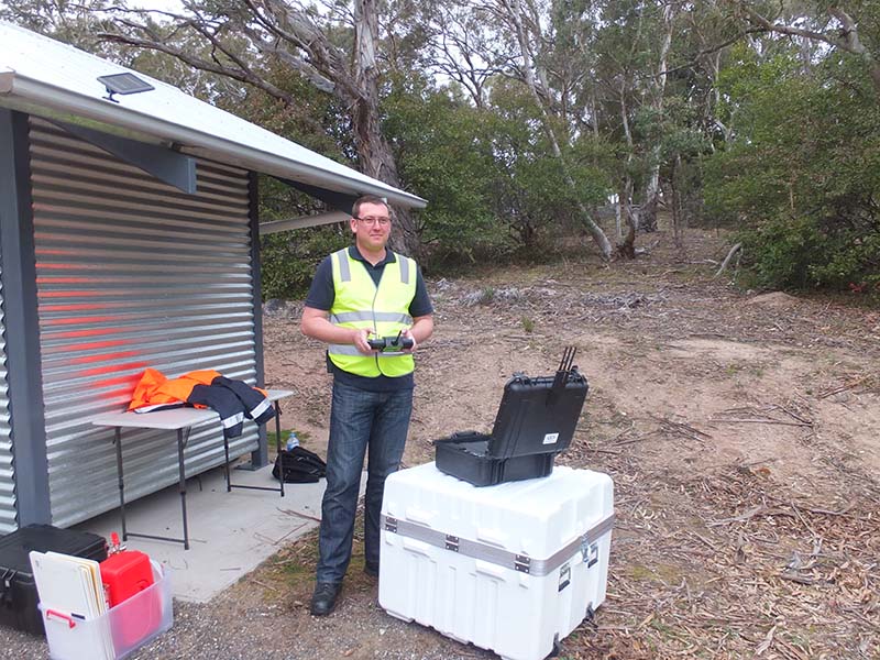
Ansvar started using drones for site surveys about three years ago, to address the ongoing issue faced by many of their clients from damaged roofs – faith-based buildings traditionally have high roofs which were hard and expensive to access.
Overtime, Ansvar has built robust modelling as well as developed their peoples’ skills to analyse information and provide greater context and understanding of the consequence to customers. Now, under Ansvar Risk, they offer Risk Quality Surveys that are completed in about an hour on site which is far more efficient and cost effective than traditional survey methods.
Mr Holland commented: “What I find exciting about the technology is that it allows us to access roofs and hard to reach places so that we can fully understand what’s happening at a site. It provides an unparalleled level of detailed information about the current state of assets. This supports customers with informed decision making, and the ability to address risks as they emerge. It therefore results in fewer insurance claims, and lower insurance premiums as the property is better maintained and issues addressed before they cause damage.
“While, flying a drone is a little like a real-life video game, there’s also lots of complexity and responsibilities to balance. The biggest challenge is being fully aware of your surroundings at all times. That means being aware of people, weather, line of site to the drone, site instructions, birds, other aircraft, power lines and vegetation. And you need to do all this while trying to get camera and drone in the right spot, so you can capture the required images and information.
“While risk quality surveys provide vital information, fundamentally risk management is about small incremental changes, it’s a step change process. When organisations make small ongoing and consistent changes they create a lasting impact. So, creating a culture that embraces risk management concepts and incorporates this into decision making is key,” he said.
What are Ansvar Risk Quality Surveys?
Risk Quality Surveys is the collection of data and information on assets such as buildings, vegetation or grounds. It often uses a combination of drones, laser technology and photogrammetry, or 360-degree cameras to quickly and effortlessly capture images from all aspects of a building or large area.
Risk identification is then performed using a series of customised tools to help determine what can happen and how it may happen. For example, the process may identify potential property and liability risks such as uneven floor surfaces, chemical storage or even people risks such as the employee screening procedure.
The data can also be geo-referenced enabling flood and storm path modelling which can be factored into the sums insured evaluation.
Real-time digital capture is responsive. Risk Advisors can immediately see current issues or potential risk exposures while they are completing the survey and can show this this to customers.